Ceterio C-350 AMR

Ceterio C-350

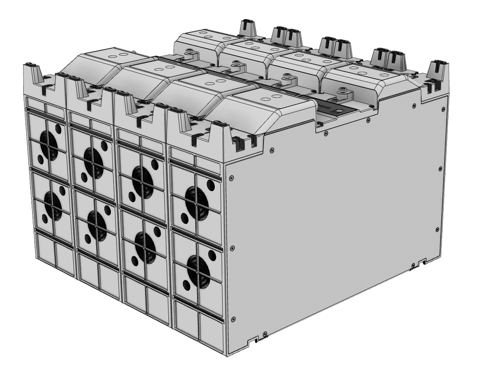
Our C-350 is a compact-size AMR capable of carrying loads up to 350 kilograms.


AMR can be equipped with other required components like for example cabinets, cobots, lift mechanisms, etc. Any additional components can be powered from the C-350 battery (outputs available 5V, 12V and 24V).

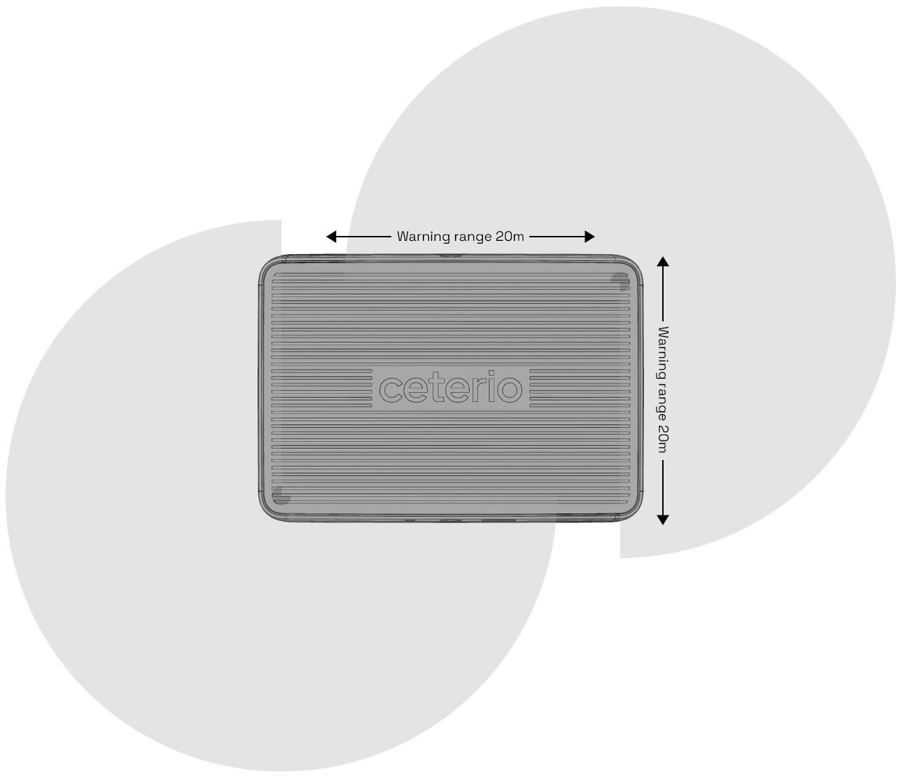
Our navigation solution uses natural environment features, does not require additional markers and is proof tested in industrial conditions.

Ceterio C-350 AMR in gray colour
Ceterio C-350 in gray colour
Ceterio C-350 AMR in white colour
Ceterio C-350 in white colour

Design Philosophy

We aim to design and develop autonomous robots that are easily approachable while being efficient and reliable.

We research and continuously improve human-to-machine interaction parameters, focusing on machine-to-human communications with movement, lights, interactions via handheld devices, UI/UX design, third-party integrations and even speech communications.


Technical Specifications

By Numbers
Power Management
Safety
By Numbers
By Numbers
Power Management
Safety

Our AMR is equipped with 1 to 4 Lithium-Nickel-Manganese-Cobalt-Oxide battery packs. One pack would give about 5 to 6 hours of constant operating time in normal conditions.

One pack specifications:

  • 58 Ah nominal capacity
  • UN 38.3, IEC 62133-2:2017 Certifications
  • 31 A Discharge current
  • 1200 cycles to 80%
  • Charging: 80% within 1 hour, fully charged in <3 hours
  • Watt-Hour Rating: 1.502 Wh
  • Charging temperature from 0 to 45°C
  • Discharge temperature from -20 to 55°C
  • Active cooling
  • Zero maintenance
  • Level 4 safety integrated
  • Intelligent battery management and charging system
  • Automatic charging in docking station, handled by AMR
mm
Width
mm
Length
mm
Height
mm
Ground Clearance
mm
Drive Wheel
mm
Caster Wheel
°
Ramp Cross Over
kg
Weight

Safety is important for us. In our design we follow driverless industrial trucks and their systems standards (ISO 3691-4:2020).

C-350 is equipped with two Japanese Hokuyo UAM-05LP-T301 Dual Protection Safety Laser Scanners (Conformity Standards IEC61496-1/3 : Type3 IEC61508 : SIL2 ISO13849-1 : PL d Category3) and with those, C-350 has full 360 degree view of its surroundings. Laser scanner warning zone is 20 meters in all directions.

In addition we use 3D stereo camera visibility in order to detect obstacle types and change behavioral logic accordingly

Equipped with NODE Navigation

Live SLAM

Localization without additional markers (“contour navigation”) even in highly variable environments? The Live SLAM realizes this through probabilistic localization methods in combination with continuous map updating.

In the basic setup, the sensor data of the 2D (safety) LIDAR sensors are sufficient for this. Optionally, further sensor systems such as 3D LIDAR, camera systems, GPS/UWB, etc. can be integrated. In addition to localization, Live SLAM provides the current map of the environment as a basis for e.g. dynamic route planning and traffic management. 

Online Route Planning

Calculate the best route at runtime even in large, variable industrial environments?

The online route planner calculates the optimal route between any start/destination at runtime based on the current map and user-defined traffic zones (such as one-way streets, no-go zones, etc.).

The route calculation takes into account robot-specific properties such as kinematics, dimensions including speed-dependent safety fields and loading condition.

Dynamic Motion Planning

Optimal motion planning despite switching safety fields?

Dynamic motion planning ensures efficient execution of the global route and collision avoidance by calculating optimal trajectories and speed commands.

It takes into account both internal constraints of the AMR (kinematics, dynamics, footprint, safety fields) and obstacles detected in real time with onboard sensor technology (2D/3D LIDAR, camera systems).

Global Live Map Server

Ensures that each AMR is always supplied with the latest environment information (live map) for localization and route planning.

Merges the map changes and environment information collected by the individual AMRs into a global live map and offers this to the AMRs as a map update for download. Ensures that new AMRs are directly equipped with up-to-date environment information and are immediately operational. Simultaneously provides an up-to-date live view of the environment (“digital twin”).